Saturday, December 31, 2011

Day 41: FIRE!

Day Forty-One: FIRE!

7/22/11:
On July twenty-second, I slouched around the Williams Ranger District, napping in Joe’s hammock while its owner got to work his very first fire. To say that I was jealous does not come close to expressing the exact emotion I was feeling at the time. Instead of digging line and getting mocked for a very clean yellow shirt (a sure mark of a firefighter newbie), I swayed gently with the breeze under the boughs of two large ponderosas.

But really, I would have liked to have traded places if even for a day.

Sadly, despite a number of fires breaking out in nearby forests, I was destined to never sniff the scent of smoke. I hadn’t taken the S-130/S-190 courses or a pack test (three miles with a forty-five pound pack in forty-five minutes or less), which meant I wasn’t red-carded and not to be trusted around any wildfires (too idiotic to know when to run I guess...?).

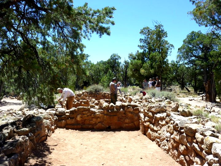
This was rather an unfortunate state to be in as Neil, Joel, and Travis, acting as fire archs, were stretched thin. Fire archs worked with firefighters to protect archaeological sites, a task that took a variety of different forms. This could mean surveying areas around the wildfire to determine if there were any sites or walking beside a dozer with an archy GPS to make sure fire lines were made around archaeological structures to protect them. Often, fire archs pitched in, digging line with firefighters and doing whatever work was needed.

The Williams Ranger District housed a couple of fire engines as well as a helicopter pad for helitack teams, and throughout the summer, a few different fire crews from Oregon and California camped out on the district lawn, called down to help out on Arizona fires. Coming back from a run on Bill Williams Mountain Trail, an incredibly fit young firefighter gave me a quick smile as she asked what the trail was like; a week or so later, another firefighter about my age made my day when, mistaking me for a fellow, she had asked me how many summers I'd been working fires.

As I observed, days spent working on a fire were often grueling. We lived with two firefighters (Micah and Tyler) at North House, although I didn’t see hide nor hair of either of them until almost a month into my internship. They’d both been out on fires, working twelve hour days and making a nice fat paycheck thanks to overtime. When Micah and Tyler did get back to North House, covered in dirt and grime, I would watch (a bit reverently) as they plowed through food just because they needed the extra carbs. 

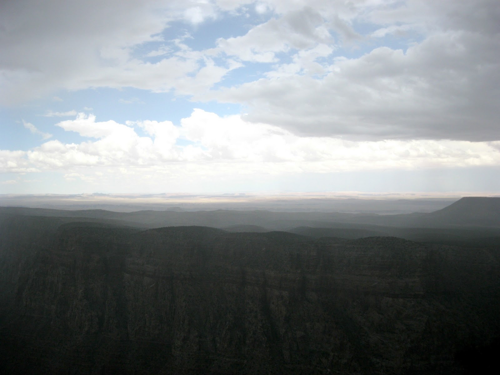
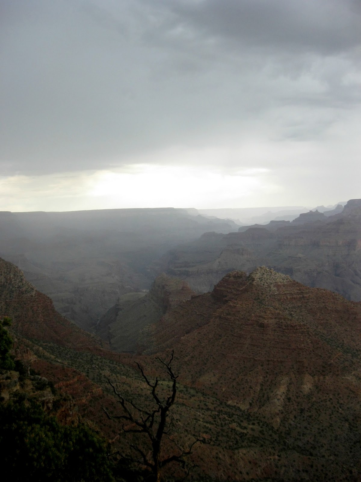
Later in July, when Neil, Travis, Joel and Joe were called out on fires, they too found themselves working long hours and over weekends, stumbling home with just enough energy to eat. They worked the Woodbridge Fire on the east end of the Tusayan District (an area thick with brush shelters, hogans and sweat lodges); they tackled the Parallel Fire east of Red Butte and the Armstrong Fire between Red Butte and the eastern Tusayan District; they slogged through the Skinner Fire in the central Tusayan District; and they finished out with the Lower Fire in the Grand Canyon and Hull Cabin area. All of these fires were caused by lightning strikes (which are apparently hotter than the sun when slamming into a tree).

Dry Arizona, with more than its share of overgrown forests, hardly stood a chance.

Admittedly a little miffed that I never got to experience one of these forest fires firsthand, I consoled myself with the knowledge that there would undoubtedly be many, many more fires (for better or for worse) in the coming years.

Which is why I’ll be out on the Grinnell track this spring with a weighted backpack and a timer, training up for my pack test and anticipating the glory of a beautiful, shiny little red-card of my own. I’d like to think that somewhere in the future, a fire and a clean yellow shirt are waiting for me.


*As of March 2012, I've passed the pack test and got myself a red-card. During summer 2012, I will be working as a wildland firefighter on the Kings Peak Wildland Fire Module on the Ashley National Forest in northeastern Utah.

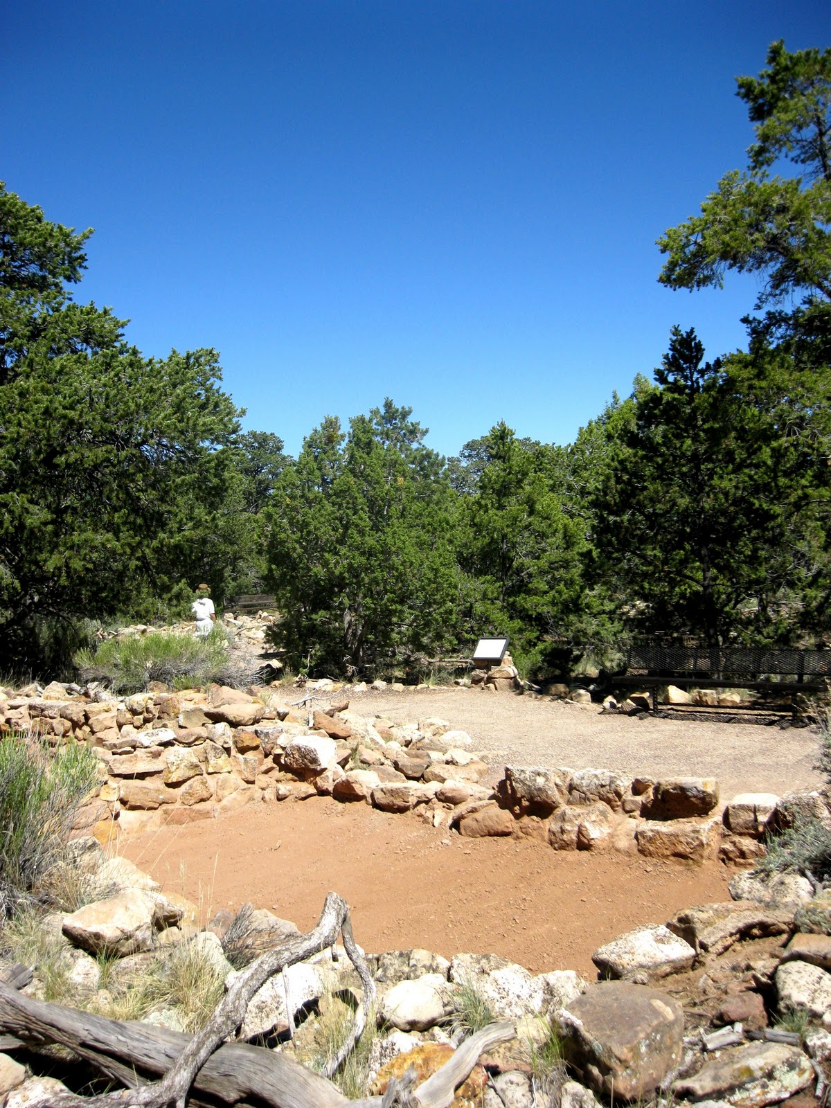
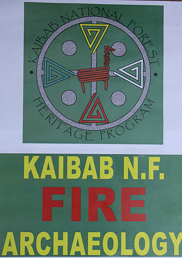
Photos: 1. Joe in his new yellows 2. & 5. FIRE! 3. Joel and Travis digging line around a brush shelter 4. KNF Fire Archaeology shirt designed by Travis and Joel (photo credit: Neil and Joe)

Day 40: In My Mind I'm Goin'

Day Forty: In My Mind I'm Goin'
7/20/11:
On July twentieth, I decided that I didn’t want a career or a home or a steady job. Nope, my true calling was to be WILD.

This moment of enlightenment came to me about midday as Noah and I surveyed around Hat Ranch knoll. The area, heavy with sky, was cut up with boulders and rock walls begging to be scaled.

Resistance had never been my forte.

Dragging Noah with me, I would momentarily halt our survey to scrabble up and down ledges, testing the steadiness of leaning rocks with a variety of flailing hops. Perching on a cliff-dwelling rock, I pushed against the wind and soaked in the blue-green view of the KNF, a pair of shed antlers (my third find of the summer) strapped to my pack.

I guess a little bit of wildness settled itself over Hat Ranch knoll too. After a day of traversing craggy hills and dipping down into shaded lowlands, we stumbled across the sun-bleached bones of four horses, tufts of hair still sprouting from above their dark hooves. The skulls were large, the teeth still anchored in their jaws lending them an oddly predatory look. Eyeing a disjointed leg, I couldn’t keep myself from testing the bend, more than a little intrigued by the smoothness of the motion and the way the bones hinged together.

A few hours later, my commitment to maintaining a WILD perspective was tested as I watched Joe, Quentin and Noah descend in a mild frenzy on our Fratelli’s appetizers and pizzas. Elbows thrown, I entered into the fray and emerged with a plate of pure deliciousness. Quentin was resigned to leaving us in the morning, and this was our final hooray. Quentin was homeward bound to North Carolina, where he would be packing up for Knoxville and a long awaited return to academia as a graduate student at the University of Tennessee.

Joe—Q’s other half—would have been inconsolable had he not been hurriedly devouring cheese and marinara sauce.

After unleashing our more animal selves upon a truly gigantic feast, we poked around Flag, let Quentin say his final goodbyes to Peace Outfitters, and headed for home.

Driving the familiar stretch of highway back to Williams, Q was already half gone to Carolina, while in my mind I thought about the earlier afternoon and how I was always going to be fighting to be just a little bit WILD.

Photos: 1. & 4. Horse bones 2. & 3. Hat Ranch knoll views 5. Final hoorays

Friday, December 30, 2011

Day 39: The Q Abides

Day Thirty-Nine: The Q Abides

7/19/11:
Rumbling around in the Tusayan District, I quickly learned that Margaret—the KNF’s Forest Heritage Program Manager—was a wealth of information. On our drive into the Tusayan, Margaret told us about her latest KNF project: researching and interviewing Basque sheepherders and their descendants. 


To this day, Basque sheepherders continue to guide their livestock around parts of the KNF. Earlier in the summer, Yelena and I had seen one such sheepherder on the southern side of Bill Williams Mountain. A number of Basque sheepherders remain in the area, and Margaret was working to collect their stories and get a sense of the Basque community as it existed in the KNF.


By about this point, Yelena, Margaret and I had wrangled through a maze of forest roads to the Emerald Mine and Lockridge Cabin. The Emerald Mine had produced ore, and beginning in 1898, the ore had been shuttled from Emerald Mine to Williams via the Atchison, Topeka and Santa Fe Railway (prior to this, ore from the area had been hauled by mules). The railway and mine gave rise to the nearby town of Anita and the mining camp Copperopolis. According to Neil’s article “Shafted!,” the railway to this area was regarded as “the little baby railroad born with a copper spoon in its mouth.”

In 1901, the Atchison, Topeka and Santa Fe Railway had kicked its tracks north from Anita and up to the Grand Canyon. This route, dubbed the Grand Canyon Railroad, ran sixty-four miles from Williams to the South Rim, ferrying passengers to the steps of the El Tovar Hotel and putting a swift end to the Flagstaff to Grand Canyon Stage Coach Line.

The Grand Canyon Railroad had operated until 1968, when the prevalence of cars forced it out of business. Restored in 1989 by Max and Thelma Biegert, the Grand Canyon Railroad continues to operate from Williams to the South Rim, despite a few more re-sellings.

The Emerald Mine, Lockridge Cabin, Anita, and Copperopolis, however, weren’t nearly as lucky.

Our job on July nineteenth was to lead construction workers to what was left of the Emerald Mine and Lockridge Cabin. As Margaret explained it, the KNF didn’t currently have the funds to try and restore the ruins (a broken-down structure), but instead of ignoring their existence, an informative sign was to be placed before it. As Yelena and I ambled around, poking about in colorful refuse, Margaret gave instructions to the construction workers.


A few minutes later, and we were back in the rig and headed for a Tusayan Lookout Tree which would also be receiving its very own informative signboard. Listed with the National Register of Historic Places, the Tusayan Lookout Tree (along Forest Road 2607 if anyone cared to venture forth) was a holdover from days when lookouts found themselves clambering up trees to keep an eye out for forest fires. When we arrived, the lookout appeared like nothing more than a scrap of wood delicately balanced at the top of a very tall tree. I am not fearful of heights, and yet a climb into those branches, especially under the threat of a fast raging fire, was not particularly appealing.


Heading back to the Supervisor’s Office in Williams, our conversation turned toward a topic I couldn’t help but find interesting: that of the free range cattle in the KNF (being from Iowa, where livestock are also behind fences, wandering cows was a startling sight). As a national forest, the KNF was public land and therefore, its resources—to an extent—were available to American citizens. In real world terms, this meant that the KNF allowed ranchers to house their livestock on its lands for a light fee, provided ranchers followed KNF policies. Despite the number of cows I’d seen wandering the KNF, Margaret guessed that only thirty or so ranchers were actually grazing their animals on forest land.


After so much talk of roaming cattle and the wandering life, I suppose that it was only fitting that I should close out my day with The Big Lebowski’s cowboy (Howdy, Stranger) narrating to me the wily adventures of el Duderino. Quentin, preparing to depart from the KNF in a matter of days, had requested the film and been met with zero resistance from Joe, Noah and me.


So it was that, White Russian in hand, I felt myself bespelled by the Stranger’s sultry tones and big caterpillar of a moustache. And, as Joe was quick to correct the Stranger, it did feel good knowin’ that yes, the Q abides.

Photos: 1. Sheeps in the KNF 2. Emerald Mine and Lockridge Cabin remains 3. Road 2607 4. Cattle roamin'

The Seventh Week - Day 38: The Grand Canyon Puts Me Back In My (Oh So Small) Place

The Seventh Week - Day Thirty-Eight: 
The Grand Canyon Puts Me Back In My (Oh So Small) Place

7/18/11:
July eighteenth rolled around and I found myself partaking in two favorite childhood activities: playing with mud and wielding a water-soaker. Well, sort of.  Noah, Yelena and I were back up at Grand Canyon National Park, continuing to stabilize the Tusayan Ruins. Today, however, I found myself promoted from thwacking rocks to mixing concrete and spraying water.

In the 1930s, when the ruins were first excavated, Portland cement was used to preserve the Tusayan Pueblo’s room blocks. However, Portland cement was stronger than the original stones and ended up cracking and damaging many of them. In order to combat this, the Grand Canyon archies today must methodically mix and test the cement they plan on using, while also taking note of the cement’s color and texture (as they want to maintain the most authentic appearance possible). These archies have developed a fairly consistent mixture: four parts soil to two parts sand to one part cement (and they do get awfully excited when talking about it!).

It was my distinguished duty to assist in this mixing process, and along with the other archies, I donned plastic gloves and grabbed a shovel. After creating a few tubs full of cement, we hauled the lot of it over to the ruins and began re-mortaring the structure. The work we had done earlier (rock thwacking at its finest) was pretty important at this stage, as we relied on the markings and notes we had made on site photos to determine which rocks needed to be sealed with cement.

Glop of cement in hand, I began the work of filling in cracks and bonding stone, Noah or Yelena periodically spraying the cement to keep it from drying too quickly. When the exhaustion of the job overtook one of us, we traded off, although admittedly, squelching cement between my fingers and menacing Noah with it was most definitely my preferred task.

Our cementing was progressing at a decent rate, and then the monsoon came a-rollin’ in. We all hastily covered the parts of the site still undergoing work and headed for the government vehicles. After a prolonged bit of rain, the Grand Canyon archies decided a brief jaunt to Desert View Watchtower was a more worthwhile endeavor then our current non-activity.

At seventy feet, Desert View Watchtower is the highest point on the South Rim of the Grand Canyon. Designed by Mary Colter and built in 1932 to emulate a prehistoric Native American tower, Desert View perches close to an epic drop into the Grand Canyon. “From Desert View…aptly named because of the view to the east of the Painted Desert…you can see the Colorado River make a big bend and continue to the west, the North Rim more than 10 miles away, and a panoramic view for well over 100 miles on a clear day.”

We were by no means visiting Desert View on a clear day, but the vista was still mesmerizing. The canyon was caught up in sheets of rain, heavy clouds laboring slowly across the horizon, as in the distance, bluer skies and marshmallow clouds made themselves tantalizingly known.

Once again, I found myself taken in by something that seemed far too rough and too untamed to exist in our world today. The Grand Canyon, carving itself out of the earth in rocky grooves, seemed to me too beautiful and too wild.

And I was so very, very small.

Photos: 1. Tusayan Ruins 2., 3., & 4. Views from Desert View Watchtower

Day 37: King Cribbage

Day Thirty-Seven: King Cribbage

7/17/11:
The game known as “cribbage” (hole-y board, pegs, Muggins) haunted many of my days at the KNF. Living a mile outside of a 3,500-person town meant a lot of free time for those of us on the Williams Ranger District. Which, of course, translated into many a summer night of games (but very, very thankfully, and despite Travis' insistence that it was fun, no Stump).

We kicked off with a secondhand set of War, progressed to euchre and 31, and somewhere along the way, Noah uncovered North House’s handmade cribbage board, and he and Quentin got stuck. At any hour, in any state of mind, cribbage was played. As the tally of games won and lost began to rise, so to did the trash talk. The punctuation of dark mutterings with a triumphant yell (usually accompanied by arms thrown up in victory) signaled to Joe and me that success had come to one or the other on the cribbage battlefield.

Quentin—a self-proclaimed cribbage fanatic—had earlier related tales of a specially designated “travel” cribbage board owned by his family, as well as enlightening us about the internet-fueled cross-country cribbage matches he held with his father. Noah had also been raised in the cribbage tradition, and the two took to the cribbage board like fishes to water.

So no, crawling out of my tent in the Coconino National Forest, I was not terribly surprised to see Quentin and Noah plopped on the back of Joe’s truck, cribbage board between them, pegs a-whirl. I may not have understood the unearthly sway cribbage held over my compatriots, but as long as they kept their pegging and verbal jabs to a dull roar, I was not overly annoyed.

We milled about a bit, Quentin and Noah battled out a few more games (by the end of the summer, the tally had risen to something like 25 - 15, with Q leading), and then we were striking out for Fossil Creek. Designated in 2009 as a “Wild and Scenic River” (to protect it from development), Fossil Creek runs thick with travertine minerals, which, besides turning the water a turquoise color, create fossil-esque rock formations. Fossil Springs, the source of Fossil Creek, produces more than one million gallons of 72 degrees Fahrenheit water per minute. The creek winds between Tonto National Forest and the Coconino National Forest in central Arizona. (Side note: Coconino is a historic misspelling of “Cohonina,” the Hopi term for the ancestors of the Yuman, Havasupai, and Walapai peoples.)

Braving yet another nasty stretch of road, Joe’s truck faithfully bore us down into the heat of Fossil Creek Canyon. Our first stop along the creek offered a good set of rocks from which to jump, but throngs of fellow day-trippers pushed us on after a while. A little farther along Fossil Creek, we discovered a semi-secluded area with a rope swing, which pretty much decided everything. I collapsed with a book in the shade of the cottonwoods to the ambient sounds of splashing and thrashing as Joe, Quentin and Noah attempted to out-leap each other on the rope swing, Noah giggling almost exactly like a twelve year old girl.

I should have expected a drawn-out lull in activity to mean trouble, but didn’t make much of it until I was hauled up by my arms and legs and thrown unceremoniously into the creek. Thus began a game of karate-attack, mostly perpetrated by Noah and Joe (Quentin instead communing with Fossil Creek’s bird population). We later wandered with the current down the creek, sipping libations and waxing poetic about the beauty of nature as it held us in its loving arms, and the incident of earlier, when an annoyed mother had inquired whether the kid dashing haphazardly about on the rocks was mine, began to fade pleasantly from memory.

Desire for food, more than anything else, drove us from Fossil Creek. The wee town of Strawberry rested just outside Fossil Creek Canyon, and fighting through the cascade of descending cars, we pushed on out, made for Strawberry, and filled up our empty bellies with scandalously oversized proportions of home-style cooking.

Taking mercy on Joe, I volunteered to take the helm on the way back to Williams, and soon enough all three lads were conked out around me. I didn’t mind. The drive back was beautiful, particularly Lake Mormon, which we passed just as the sun began to sink.

Back on the ranger district, shaking off their sleep, I do believe Quentin and Noah rounded out the day with predictable style: wrastling through one last cribbage match.

Photos: 1. Quentin and Noah, Cribbage Lords 2. Drive to Fossil Creek 3. & 4. Fossil Creek 5. Fossil Creek Canyon

Sunday, December 25, 2011

Day 36: Veni, vidi...vici

Day Thirty-Six: Veni, vidi...vici

7/16/11:
On July sixteenth, Joe, Quentin and I tried to kill ourselves.

A week earlier, I had (quite stupidly) projected my intent to run the entirety of the Bill Williams Mountain Trail. Upon hearing this, Quentin and Joe both jumped at the opportunity to test their mettle against our friendly neighborhood mountain.

But let’s review the facts of my statement:

Bill Williams Mountain Trail runs from the Williams Ranger District (base of the mountain) to the Bill Williams Watchtower (peak of the mountain).

The Bill Williams Mountain Trail rises 2,200 feet, changing from 7,000 feet of elevation to 9,200 feet.

It does this in three miles.

Of course, we weren’t planning on bumming around on top of the mountain, which meant that we’d be running those same three miles back down.

Like many things I have done in my life and later regretted, it seemed like a great idea at the time. I had, after all, been running regularly; I had, after all, adjusted to the Williams elevation; I had, after all, run to the two-mile marker on the Bill Williams Mountain Trail before, which was two-thirds of the way to the top.

How bad could an extra measly mile up and an extra measly mile down really be? (Cue evil cackling.)

Well, the first two miles weren’t so bad. Quentin took off like a shot, which given his competitive bike racing career wasn’t entirely shocking, while Joe and I labored on within sight of each other. I passed the two-mile marker and fervently wished I’d bothered to apply some sunscreen as I could practically smell my own flesh frying, but regardless, I pushed forward.

Then came the switchbacks. I was huffing, puffing, and feeling fairly weak in the knees, and it wasn’t because of the shirtless sixty-year old hiker asking me if I was doing okay. Frankly, had the sounds of Joe crashing along the trail behind me not echoed forth, I probably would have called it quits right there, plopped down on the trail, and waited for my head to stop feeling like a highly pressurized tomato.

But if I am anything, I am a creature of pride, and dammit, I was not going to wimp out on my own goal while Quentin and Joe completed it.

After frantically gulping the kind gentleman hiker’s water, I trudged on, my legs screaming profanities. (I was to later learn that along this part of the trail, Quentin had discovered a rare botanical wonder, and galvanized by its beauty, had skipped merrily up the mountain.)

With an unearthly gasp, Joe surged by me at the bend of a switchback. Actually, he shambled by faster than my limp, but still, he propelled himself onwards. I watched him go without feelings of shame. This had quickly evolved from a (wo)man vs. man conflict to a (wo)man vs. nature one, which meant the mountain, not my fellow Kaibabites, were the foe.

The last bit of the Bill Williams Mountain Trail hooked up with the mountain road, which meant it wasn't much shaded, but it was made of hard packed dirt and a smoother rise.

About four-hundred meters from the end and a few moments before Quentin and Joe broke into speed-inspiring song for me, an overly-done woman sneered at me and proclaimed, “They beat you!”

If I hadn't been minutes away from exhausted collapse, I undoubtedly would have unleashed the fury of my eyes on her; instead, all I managed was a strangled garbling noise before rounding the corner, seeing my fellows, and stumbling up the last few feet of the mountain.

Oh goody, I thought cheerily, we're halfway done!

We rested for a bit, I clambered up to the watchtower with the sole purpose of mooching water off the lookout, and we headed back down “together.”

Quentin, the wee mountain goat that he is, set the pace, and Joe and I fell in closely behind. About a mile down, I started to lose my controlled stampede and hurtled forward on legs that may or may not have been paying any attention to what my mind was telling them to do. I was getting that tight feeling around my temples and my head felt absolutely empty.

As we passed a group of hikers, I missed a step and ate it, sliding on my knees and hip. There wasn’t much to say about it; I was dusty and bloody, but I’d fallen more than a few times before while on runs, and we kept going. I’d never fallen twice on any run in my life though, so stupidly I kept my same pace, taking the early wipeout as insurance that I’d not have another.

Wrong.

About a mile farther, I crashed down again. I got up, blinking, waving Joe and Quentin on as I tested out a slow jog. Ahead of me, Joe went head over feet, his flailing legs rolling into the air.

I may have laughed at the sight. Just a tiny, tiny bit.

As I passed him, the look on his face was of complete and utter pain. Under normal circumstances, I considered myself a decently compassionate and empathetic person. And yet today, I did not give a flying fuck. I had a shiny new goal, borne from the blood of the last two falls: I wanted off the mountain.

I slid by Joe and down the last leg of the trail, back in familiar, oft-run territory now. I could make out Quentin up ahead as I pushed down a switchback. I came up to him on the final flat, and we dead sprinted to the end: me out of sheer desire to please let this be over NOW, and Quentin out of exuberance for such a wonderful little jaunt.

Joe followed soon after, and stinging from my knees to my elbows, we walked back to North House. Quentin, remarking on the lovely weather, inquired if either of us would like to join him on a bike ride shortly.

I do not believe my answer was in the form of any coherent language. Back at North House, I labored to scrub the grit out of my road rash. I’d torn a nice little chunk out of the palm of my hand, scrapped up my knees and hip, and lost a five-inch piece of skin off my arm.

The whole six miles had taken us two hours. As a limp and unmoving body in bed soon afterwards, I was undeniably proud to have mastered my goal, but more than anything, I was glad that the ordeal was definitively over.

I got a few hours of recuperation time before I was packing up my backpack, stuffing my sleeping bag into its itty bitty case, and walking out the door. Quentin, Joe, Noah and I were heading for Fossil Creek by way of the Coconino National Forest. For dinner, we slurped up delicious Mexican food at Tacos Los Altos outside of Flagstaff; back in the car, Joe and I sang along to the music and attempted to drown out the sounds of Quentin and Noah’s cribbage game. Yes, the cribbage fiends had broken out their travel board.

Venturing into the Coconino a few hours later, we made camp right quick, and while los hombres took in a lovely starry night, I took my bruised, beaten (but not yet defeated) body to my tent.

I'd gone, I’d seen, I’d almost died…but yes, I’d conquered. 

Photos: 1., 2. & 6. Bill Williams Mountain Trail 3. View from halfway up Bill Williams 4. Not Quentin's special flower, but a flower on Bill Williams nonetheless 5. View from Bill Williams Lookout Tower 7. The travel cribbage endureth

Day 35: If you’ll be my bodyguard, I can be your long lost pal

Day Thirty-Five: If you’ll be my bodyguard, I can be your long lost pal

7/15/11:
When I learned that Noah, Yelena and I were going to be helping out the Grand Canyon Archaeology crew, I expected a job of glamour and glitz. Of course, I ended up thwacking at rocks, which was infinitely better than anything I had imagined.

The Grand Canyon archies were stabilizing the Tusayan Ruins, one of the major archaeological sites in Arizona. Located near the end of a road that wound by the lip of the South Rim, the Tusayan Ruins were a partial excavation of a pueblo dating from A.D. 1185. None of the structures of the Tusayan Pueblo had been reconstructed, and the room blocks that were excavated by an archy crew in the 1930s stood just below knee level. The horseshoe-shaped ruins appeared to have only been inhabited for about twenty-five years by thirty people or less; the pueblo included storage rooms, living quarters, a plaza and two kivas (spaces used for ceremonial and religious rituals). The Tusayan Ruins were excavated to serve as an interpretive archaeological site—allowing the many Grand Canyon tourists to experience the history of the surrounding area and peoples.

The stabilization undertaking we were working on occurred every five to ten years depending on the state of the room blocks. The whole point of stabilization was to maintain the excavated walls of the room blocks, which meant paying detailed attention to rock placement and the overall appearance of the ruins.

Which is why I found myself crouched in a room block with a spade and a trowel, hammering at rocks. In order to stabilize the ruins, we had to know which rocks were sitting loose and needed another seal of cement. Thus, I had been impelled to push, shove, lean on and otherwise forcibly jostle the excavated wall (within reason--more than anything, the crew wanted to preserve the original room block rocks). When a stone popped, I marked its placement on recent photographs of the ruin, noting its measurements and angles so that it could be returned to its exact spot. Similarly, when the cement binding stones together appeared weak, I was instructed to have at it with various sturdy implements until the sealant had been chipped away and could be replaced with fresh mortar.

The Grand Canyon archies called out helpful bits of advice as we made our steady progress, and crouching in the dirt, I didn’t bother to contain my satisfaction after wedging free a particularly troublesome rock. The Grand Canyon archies, like almost everyone I’d encountered in the national forest and park services, were both knowledgeable and genuinely happy to be doing what they were doing.

The tourists, however, continued to disconcert me. In the KNF, I was used to carrying out my work in unbroken (and beautiful) silence. Sweating, muttering, and struggling with rocks, I was not thrilled to be surrounded by a constant stream of curious people, many of whom assumed I was an expert archaeologist (so very, very false). I will not deny, however, the relished moments that came with photobombing a good number of vacation pictures. Yelena, Noah and I, fussing with our rocks, will undoubtedly be sealed into photo albums all around the world.

Finishing up in Grand Canyon National Park, we headed back to Williams briefly before hitting up a party in celebration of Joe and Quentin in Flagstaff. Hanging out with fellow Kaibabites outside of work was particularly entertaining, and only after a good few hours did Quentin, Noah, Joe and I head for home.

Crammed into the back of Joe’s truck with Mr. Long Legs himself, Quentin at the helm and Noah beside him, we delivered a rousing rendition of Paul Simon’s “You Can Call Me Al” to anyone within hearing distance. Laughing, I spent the rest of the ride home pondering why, indeed, I was so soft in the middle now.

Then again, I guess my life isn’t so hard.

And yes: if you'll be my bodyguard, I can be your long lost pal.

Photos: 1. & 3. Tusayan Ruins 2. Tusayan Ruins interpretive sign 4. Noah, Quentin, Joe and me at Parson's Creek earlier in the summer

Day 34: Resistance and Accommodation

Day Thirty-Four: Resistance and Accommodation

7/13/11:
After a few minutes of lost wandering through the San Felipe Pueblo, I pulled our car over outside of a house with a hand-painted sign advertising water-for-sale. A little girl sat in the doorway surrounded by a veritable herd of floppy, big-pawed puppies. While Mom asked the young girl’s mother about the location of yet another adobe church, I dropped down to my knees and was quickly swallowed into a mob of tiny tongues, teeth, and fur. The girl poked at them indiscriminately from her perch, telling me their names, asking if I had a dog and would I like another one? I declined her gracious offer and thanked her, laughing as two surly little puppies fell over each other.

Back in the car, it was discovered that we were still a bit muddled on directions. The woman hadn’t been aware of any adobe churches of particular significance in the Pueblo. She claimed that the old church on a nearby mesa was in ruins and nearly impossible to reach, though we were more than welcome to look at the new church a few streets down. Driving the narrow streets, Dad laughed as our car rolled up before the “new” church. In the same colonial style as the others, this was the adobe church we had been looking for.

Like the church in the Santo Domingo Pueblo we’d detoured to earlier that morning, the San Felipe church sported a pair of elaborately rendered rearing horses around its large front doors. The horses represented visible signs of early tensions and fusions of two different cultures; the priests of both churches disliked the inclusion of animals, and soon after the construction of the churches, sought to remove them. However, their Native American congregations were having none of it, and every year the horses were (and still are) dutifully repainted—a reaffirmation of Native American traditions within their Christian faith.


Against the white adobe, the brightly colored horses sprang forth from the church: resistance and accommodation. I lamented the prohibition on taking pictures, even as I understood it. This “new” adobe church, like all those we had seen before, was still very much alive, a conflation of Native American and Christian traditions. Returning to the car, we all remarked with curiosity on what the “old” church, settled high on the San Felipe mesa, must be like.

Our intended destination was Albuquerque, and after these two detours, we continued on the scenic winding way. Albuquerque, apparently a desirous area from which to launch hot air balloons, did not disappoint, and making our way into the city, I watched a distant balloon bobbing back and forth in the yawning sky.
We next tumbled out of our car at el Paseo del Bosque (also Riverside) Trail. A sixteen mile stretch of smooth black asphalt, el Paseo del Bosque Trail ran parallel to the east side of the Rio Grand bosque and into downtown Albuquerque. We took to the blacktop in the sweltering early afternoon hours and pushed along under the faint shadows of the cottonwoods. Off in the distance, the Manzano Mountains were blunted by rolling clouds.

We biked a total of twenty-eight miles in around an hour and a half, Dad and I managing negative splits on the return trip. Neck to neck for the last few miles, Dad sprinted off on the last stretch of the trail, and I tucked in behind him, determined to pace him out. Flying over the last bridge, we both screeched to a halt, red-faced and gulping, at the parking lot. We’d cut five minutes off our time and inevitably burst a number of small, overtaxed blood vessels along the way (totally worth it). Mom followed at a more sane speed, and trundling our bikes back onto the car rack and our bodies into the air-conditioned interior, we set off for the Albuquerque Amtrak Station.

Neil—being awesome, as always—had given me a few days off work to poke around New Mexico with my folks, and now it was time to head back to Williams. Despite a population size of 3,500, Williams did boast an Amtrak Station, and waving goodbye to Mom and Dad from the second-storey train window, I settled in for the ride back to Arizona. Tuning out the inept attempts of the middle aged man in front of me to flirt with his much younger seatmate, I engaged in one of my all-time favorite activities: looking out windows. I watched the green landscape flush brown and then red, shielding my eyes as the light crescendo’d and then sank into dusk and night-dark.

Hours later, I disembarked at the Williams Amtrak “Station,” which revealed itself to be an ill-lit strip of concrete in the forest about ten miles outside of town. Standing in the dark with my suitcase, the train a series of blinking red lights in the distance, I waited for Joe and his truck at the end of the dirt road and felt, strangely enough, like I was coming home.

Photos: 1. El Paseo del Bosque Trail 2. Dad and Mom on the trail 3., 4. & 5. Amtrekkin' from New Mexico to Arizona 6. Williams Amtrak Station 

Thursday, December 22, 2011

Day 33: Nuevo México - “Land of Enchantment”

Day Thirty-Three: Nuevo México“Land of Enchantment”

7/12/11:
My dad soaks up information like a sea sponge. At fifty-seven, he’s fairly bloated with knowledge, which is generally a good thing, although rarely results in straightforward or simple answers to any question. In full professor mode (he’s been teaching for twenty-nine years), Dad unearthed a string of colonial adobe churches for us to visit as we explored New Mexico. On our way to Taos from Santa Fe on July twelfth, we made three side ventures to El Santuario de Chimayó, San José de Gracia, and San Francisco de Asis churches.

These three adobe churches are some of the only examples of North American indigenous architecture still in existence. Decried as “primitive” in the nineteenth century, many adobe churches in the Southwest were remodeled in the New England clapboard style. It wasn’t until the twentieth century when a number of artists—among them Georgia O’Keeffe—popularized these adobe structures that many realized the beauty and worth of this early architectural style.

Walking onto the plaza of El Santuario de Chimayó was like entering into a little piece of Mexico. A row of colorful, seven-foot tall crosses stood out against the backdrop of the T’si Mayoh Mountain; little ribbons, papers with prayers, and crosses wrapped themselves around the links of the entryway fence; a shrine to La Virgen was hung with flowers and brightly beaded rosaries. El Santuario de Chimayó was, and remains, a place of healing. Before the construction of the church, this site had been sacred to the Tewa Native Americans. According to Tewa tradition, a spring had bubbled from this site and given the nearby earth strong healing powers.

In 1811, Spanish settlers to the area also found this site to be extraordinary. As lore has it, a large crucifix was unearthed from the ground at this spot and carried eight miles to the nearest church in Santa Cruz. However, the next day the crucifix returned, and again the settlers brought it to Santa Cruz. Yet, after the crucifix’s third reappearance, the settlers took heed and built El Santuario de Chimayó. A six-foot crucifix is now sheltered under thick adobe walls, and El Santuario de Chimayó remains a place of healing to this day. Beside the church, a long wall stands with a heavy coat of prayers tacked to it.

Passing through an area of thick forest and sweeping mountain roads, we lost elevation and came to the San José de Gracia church in Las Trampas. Built in 1780, San José de Gracia is ringed by a short adobe wall, clumps of golden straw visible within the dense, dried clay. The church was closed and, as told by the shopkeeper across the way, much less visited than El Santuario de Chimayó. The gentleman’s shop boasted an odd array: baubles and postcards and small figurines. Flipping into Spanish, he told my dad that he was a direct descendant of the family that had founded Las Trampas in 1751. The shopkeeper’s friend chimed in, and sitting in the haphazard and crowded shop lawn, they told me about their sixteen years working together on a hotshot firefighting crew in California. Season after season of incredible heat had caused permanent nerve damage to the shopkeeper’s friend’s feet, and he spoke nostalgically of the day when he was forced to retire his nail-studded firefighting boots.

We rounded out our morning with the San Francisco de Asis church in Ranchos de Taos. This church, with its smooth buttery buttresses, has inspired many an artist and was most famously depicted by Georgia O’Keeffe. Built in 1771 and completed in 1816, “it is understandable why the apse of this mission church has been so often photographed and painted: it proclaims geometric satisfaction mixed with naive forthrightness.” San Francisco de Asis, along with San José de Gracia and El Santuario de Chimayó, all remain active churches to this day.

Our adobe-church-tour thus sated (for the day, anyway), we commenced onward into Taos for a bike ride. Risking life and limb alongside the highway, we shot eleven miles out to Arroyo Hondo, edged six miles to Arroyo Seco on back roads, and finished out with a stormy eight miles back into Taos. The Sangre de Cristo Mountains ringed the skyline around us as we wove through the countryside, flying down long stretches of sharp descent and peddling furiously up short but insanely steep hills.


Driving back to our Santa Fe KOA after the bike ride, I cruised down some remarkable mountain roads and got to navigate lower gears for the first time, feeling disproportionately pleased with myself as I got the hang of downshifting. Passing the Rio Grande as the sun set, I watched the cloud-heavy sky throw itself in purples and blues across the water.

Arizona may have stolen my heart, but New Mexico was undeniably carving itself a place of its own there.

Photos: 1. San José de Gracia 2. San Francisco de Asis 3. Taos to Arroyo Hondo 4. Arroyo Seco to Taos 5. & 6. Rio Grande from Taos to Santa Fe